We also accept payments via Paypal
Huri Translations
Tel. +689 89 205 483
info@huri-translations.pf
PO BOX 365 Maharepa
98728 Mo'orea
French Polynesia
N°TAHITI 876649
Subscribe to our newsletter

The Linguistic Artistry
Going deeper into our relationship with the stars, it becomes evident that every aspect of our navigation has a corresponding term in our local languages. The lexicon developed across centuries of observation and sacralization underscores the intrinsic connection started between the ancient mariners and their celestial guides. For instance, the Hawaiians use the term Piko o Wākea (Navel of Wākea) to describe the Equator. In fact, various units of measurements were anthropomorphic, based on body parts, making navigation an almost tactile experience. The Pīʻā (Hawaiian term for the shaka) was a common unit, equivalent to the distance between the thumb and little finger when stretched apart. Some of these bodily units were used to gauge declination (the angular position of stars above the horizon). These indigenous terminologies not only highlight the technical prowess of Pacific people but also our intimate, personal relationship with the vast cosmos to navigate.
Stars: The Navigators' Allies and Inspirations
To these ancient seafarers, stars weren't just practical tools. Some believe that particular stars hover directly over major islands, such as when Hawaiian sailors use Hōkūleʻa (Arcturus), the zenith star of Tahiti to find their way to the island, weaving astronomy deeply into our cultural and navigational narratives. But with the sky father as a guide, the role of precession becomes critical. This phenomenon, the gradual shift of Earth's spin axis relative to stars, evolves over roughly 25,800 years, causing stars to drift from their familiar positions.
Given this, how did Pacific wayfinders account for such shifts, and what methods did they employ?
Crucial Astronomical Concepts
To fully understand precession's impact, David Goodwin, from the University of Ōtākou, exposes several terms that merit clarity:
- Declination: Analogous to latitude, it's the star's angle relative to the celestial equator.
- Right Ascension: This is akin to longitude and tracks the star's position as the Earth orbits the Sun.
- Observer’s Meridian: A conceptual plane that includes the observer and the true north.
- Azimuth: It's the angle from the true north to a star or celestial object.
- Altitude: This measures a star's height above the horizon.
- Zenith Distance: The complementary angle to altitude.
Techniques for Latitude Determination
Goodwin says the Polynesians employed four primary non-instrumental methods:
1. Altitude of Stars in the Meridian: By measuring a star's zenith distance and adjusting for its declination, navigators could determine latitude. Approximate tools, like Haga (Niuean term for hand span) were sometimes used for this purpose.
2. Zenith Stars: These are stars that passed directly overhead, often linked with major islands.
3. Verticality of Star Pillars: Pou (Tahitian term for Pillar), either single zenith stars or pairs, could be used to gauge latitude. Their alignment could hint at the observer's latitude.
4. Simultaneously Rising or Setting Stars: By observing when stars rose or set, navigators could ascertain their latitude.
Precession's Influence on Navigation
Goodwin explains that, over centuries, precession can notably alter these methods. From AD 1000 to 2000, stars like ʻAukele (Hawaiian term for Aldebaran), ʻAnamua (Tahitian term for Antares), and Werewereri Iyefaŋi (Woleaian term for Polaris) underwent changes in their declinations due to precession, potentially affecting their utility in navigation.
Azimuth determinations too are affected by precession. While phenomena like bird migration paths, such as that of the Turraaturaq (Iñupiaq term for the bar-tailed godwit), might remain constant, the positions of guiding stars will drift. This means that if a voyager relied on a star's position, they would need to account for the shifting azimuth caused by precession over generations.
In 2015, Inuits told NASA they noticed that sunrise had changed from its usual azimuth and the University of Texas confirmed the North Pole shifted due to climate change, which is itself the result of global warming. Among the causes, NASA said melting ice is changing the distribution of waterʻs mass on the globe.
Concluding Thoughts
The Pacific navigational legacy is a testament to human ingenuity and adaptability. The understanding of precession and its effects on star-based navigation deepens our appreciation for the expertise these ancient mariners possessed. As we look to the stars, just as they did, we're reminded that while the heavens may shift, the drive to explore and understand remains a constant beacon across time.
The Stars of Oceania: How Precession Impacts Traditional Navigation
Inuits told NASA they noticed that sunrise had changed!
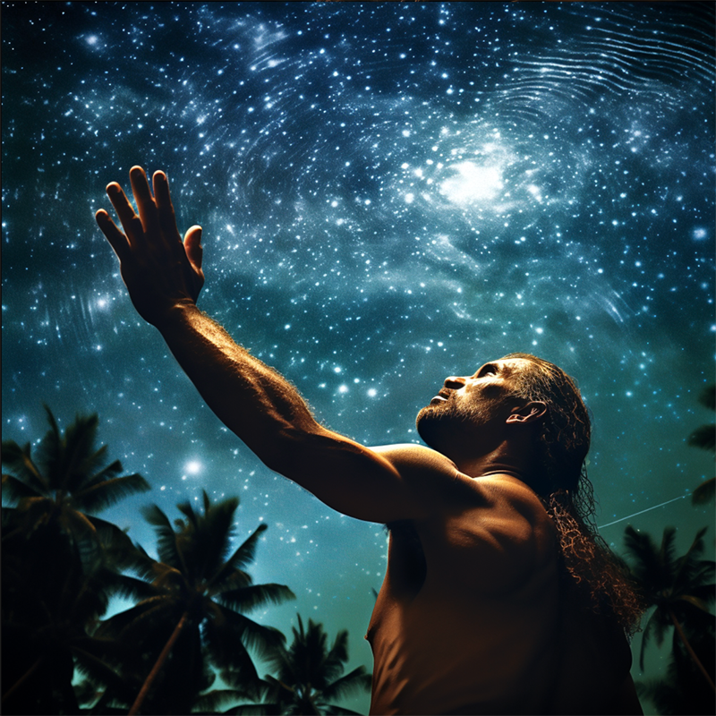
For millennia, humans have looked to the skies to guide their paths. In the vast Pacific ocean, navigators mastered the art of reading the stars to traverse great ocean distances. However, an understanding of how the Earth's slow wobble — or precession — influences this celestial compass is vital to grasp the depth of their navigational prowess.
Navigating Before Modern Tools
Before the late 17th century, sailors worldwide depended largely on dead reckoning to gauge their position, a method fraught with potential inaccuracies. True advances in determining longitude at sea came only with inventions like marine chronometers, sextants, and the proliferation of astronomical data in the 18th century.
For Pacific Islanders, the stars served as invaluable signposts. Apart from noting patterns in swells and bird behaviors, early voyagers were adept at discerning latitude and azimuth using the sky vault. The depth of their astronomical knowledge is epitomized by their use of star compasses, instruments founded on the movements of multiple stars.