We also accept payments via Paypal
Huri Translations
Tel. +689 89 205 483
info@huri-translations.pf
PO BOX 365 Maharepa
98728 Mo'orea
French Polynesia
N°TAHITI 876649
Subscribe to our newsletter

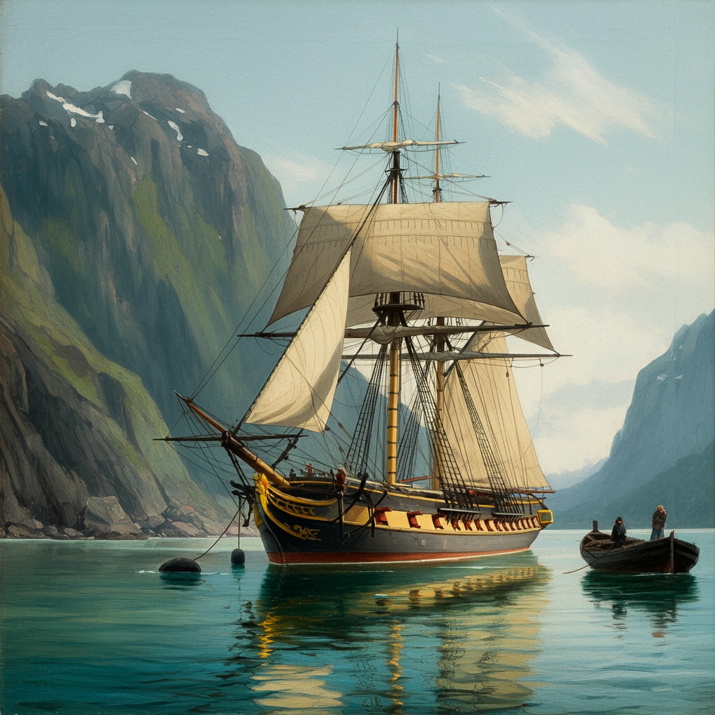
When the first Russian circumnavigation of the globe led by Adam Johann von Krusenstern entered the Pacific in 1804, it marked Russia's arrival as a significant player in Pacific exploration. Krusenstern and subsequent Russian navigators like Otto von Kotzebue, Fabian von Bellingshausen, and Friedrich von Lütke made important contributions to mapping and naming features across the Pacific Islands over the next few decades.
The Russian approach to toponymy in the Pacific followed some common patterns.
Eponymy - naming places after people - was frequently used to honor sponsors, expedition members, or Russian military heroes. For example, during his brief stay in the Marquesas Islands, Krusenstern named a harbor "Port Tschitschagoff" after the Russian Minister of Marine. This harbor encompassed Hakauʻi and Hakatea on Nuku Hiva and exemplifies how many Russian names were later replaced or fell out of use.
However, Russian navigators also made efforts to learn and record indigenous place names, albeit with varying levels of interest and success. During Krusenstern's stay in the Marquesas, his officers and naturalists spent time ashore interacting with locals and attempted to document Marquesan toponyms. They recorded names like "Schegua" or "Zhegaue" for a valley (Hakauʻi) while trying to capture unfamiliar phonemes.
The extent to which indigenous names were prioritized often depended on the inclinations of individual navigators and the nature of their encounters. Otto von Kotzebue, who had served under Krusenstern, showed a particularly strong interest in indigenous geographical knowledge during his explorations of the Marshall Islands in 1816-1817. After developing warm relations with Marshall Islanders over several weeks, Kotzebue recorded detailed local names for atolls and incorporated them into his maps alongside Russian names. For instance, he used double nomenclature, listing both Russian and indigenous names for newly charted atolls. He recorded chain names like "Ratak" and "Rālik," and local atoll names such as "Otdia" (Wotje) and "Miadi" (Mejit).
Kotzebue's approach demonstrates how prolonged, positive encounters could lead to greater valuing and recording of indigenous toponyms. His friendship with islanders like Lagediack, who taught him local words and drew maps in the sand, allowed Kotzebue to absorb substantial local geographical wisdom. Similarly, Kadu, the Woleaian who traveled with the expedition for eight months, provided extensive information on place names across Micronesia, also acting as a translator to the crew.
Friedrich von Lütke's expedition to the Caroline Islands in 1826-1829 further illustrates the complex interplay between Russian and indigenous naming practices. While Lütke named the island group he explored the "Senyavin Islands" after Russian admiral Dmitry Senyavin, he also made significant efforts to record local island names such as "Pouynipète" (Pohnpei) and "Andema" (And or Ant Atoll). On Kosrae, which he called "Ualan," Lütke meticulously recorded local district names along the coast, demonstrating a keen interest in indigenous geographical knowledge.
However, the nature of encounters could also negatively impact naming practices. After a hostile reception on Pohnpei, Lütke named one location the "Port of Hostile Reception" (Today's Kolonia).
In the Tuamotu Archipelago, Fabian von Bellingshausen's 1820 passage resulted in mostly Russian eponyms for the atolls he visited: Moller Island (ʻĀmanu) in honour of Vice-Admiral Moller, Prince Volkhonski Island (Takume), Lazarev (Mataiva) after Captain Lazareff, etc. However, he did record the local name "Nigiru" (Nihiru Atoll) after a friendly encounter with islanders. This isolated instance of recording a local name highlights how limited interaction often resulted in fewer indigenous toponyms being preserved.
While individual Russian navigators like Kotzebue made sincere efforts to record indigenous toponyms, there were limits to this practice. Krusenstern's influential atlas and hydrographic memoirs of the Pacific from the 1820s often privileged European names over local ones, seeing them as more reliable for navigation. This reflects the tension between valuing indigenous knowledge gained through direct encounters and conforming to European scientific and cartographic norms.
The Russian experience in the early 19th century Pacific, from the Aleutians to Micronesia, reveals how toponymic practices were shaped by the nature of cross-cultural encounters. Sustained contact, as in the Aleutians, or unusually positive short-term interactions, as with Kotzebue in the Marshalls, tended to result in greater adoption and recording of indigenous place names. However, the degree to which this local knowledge was ultimately incorporated into official cartography and navigation materials varied.
In areas of brief Russian presence, such as Hawaiʻi, Russian naming was limited. They nevertheless did establish Fort Elizabeth (Елизаветинская крепость, Pāʻulaʻula) on Kauaʻi in 1817. Similarly, the short-lived Russian presence on the North Pacific coast led to names like Fort Ross in California, though these often didn't persist long after Russian withdrawal.
The Russian approach to Pacific toponymy thus reflected both the realities of their encounters with indigenous peoples and the broader scientific assumptions of the era. It varied greatly across the vast expanse of our Pacific ocean, influenced by factors such as duration of contact, nature of encounters, individual navigator preferences, and the specific cultural and geographical contexts of each region they explored.
This complex interplay between Russian and indigenous naming practices raises intriguing questions about the long-term impact of these early encounters on modern Pacific cartography and cultural memory. How have these naming patterns evolved over time, and what can they tell us about the ongoing negotiation of identity and power in the Pacific region?
In the early 19th century, as Russian expeditions ventured into the Pacific Ocean, they engaged in the practice of naming geographical features and recording indigenous toponyms. This process was shaped by encounters between Russian explorers and the indigenous peoples of the Pacific ocean.
"the inclinations of individual navigators and the nature of their encounters"
The Russian Empire had been gradually expanding eastward for over 250 years, reaching the Pacific coast and establishing colonies in Alaska by the early 1800s. This expansion brought Russians into sustained contact with indigenous populations, particularly the Aleuts. As settlers lived among and intermixed with indigenous groups, some native place names like "Kadjak" (Kodiak) were absorbed into regular Russian usage over time. In Alaska and the Aleutian Islands, Russian naming strategies included using prefixes like "Novo-" (New) with existing Russian names (e.g., Novoarchangelsk, now Sitka, AK.), applying saints' names (e.g., Petropavlovsk), or honoring explorers and conquerors (e.g., Bering Strait, Khabarovsk).
The Russians and Pacific Island Toponyms in the Early 19th Century